
Lake Boren Esplanade
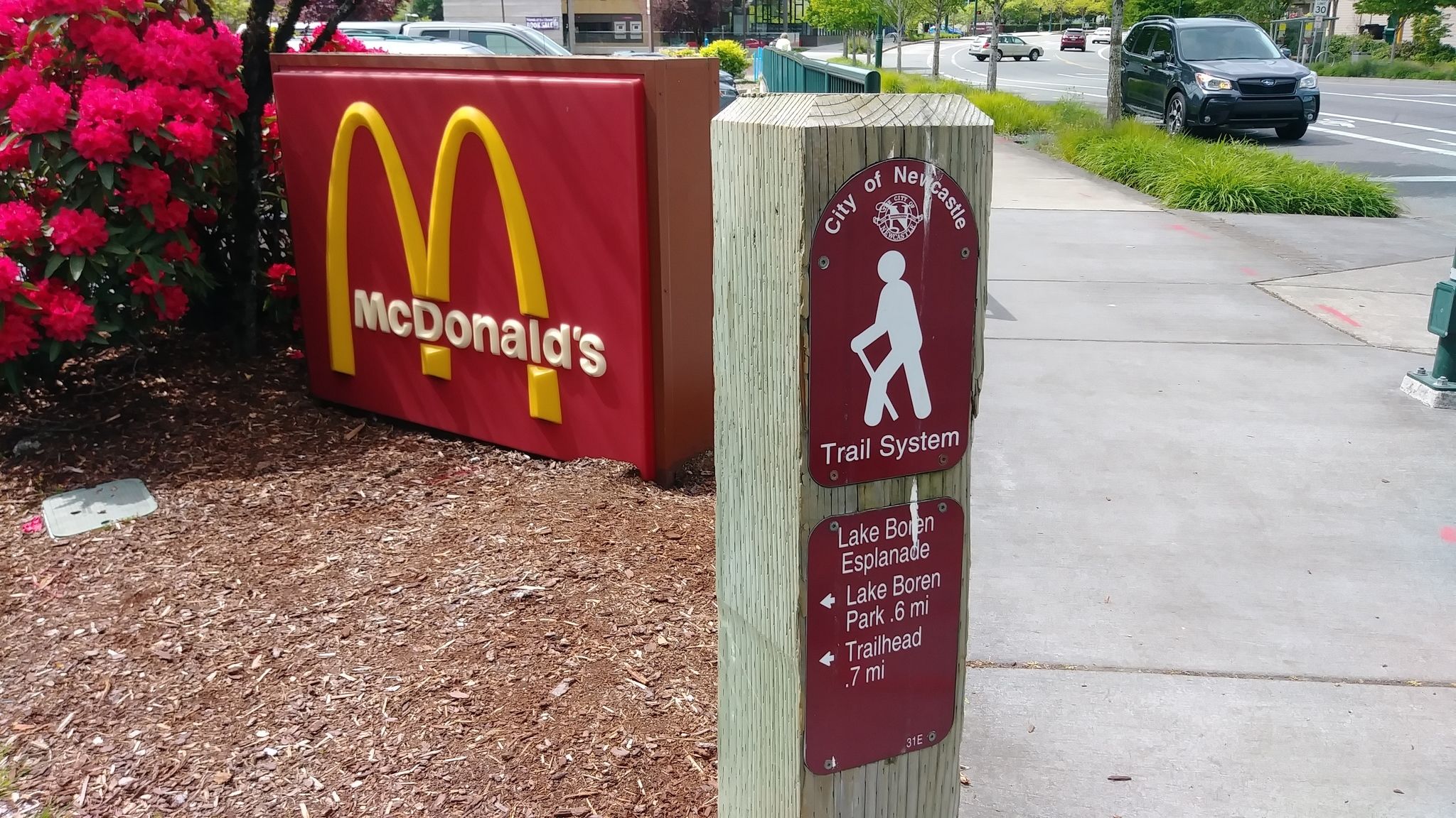
01 Trail sign at Newcastle Way + Coal Creek Pkwy
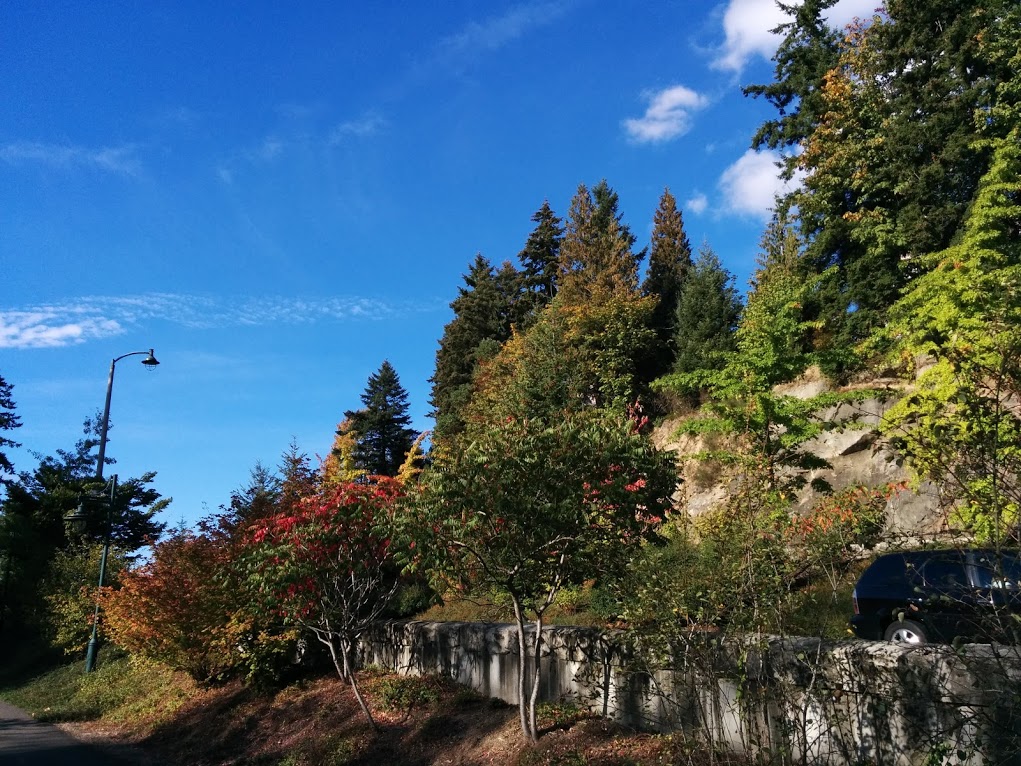
02 Autumn colors on the Esplanade
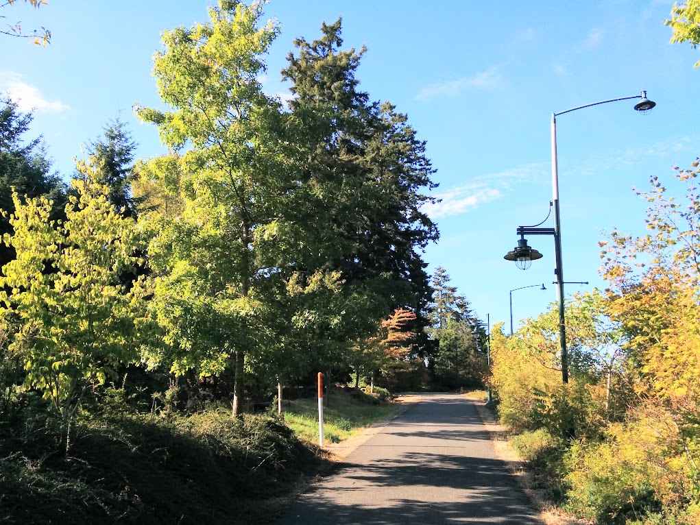
03 Middle of the esplanade between Lake Boren and Coal Creek Pkwy
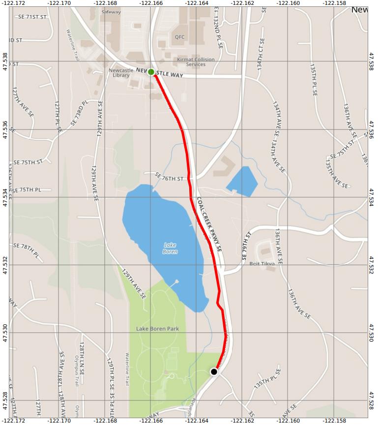
Overview
0.6 miles
1 Road,
4 Driveways
![]()
![]()
From Newcastle Way south on Parkway past Lake Boren Park to entrance
Description
The Lake Boren Esplanade is a wide, paved urban trail running south along the west side of Coal Creek Parkway with views west to Lake Boren. It starts at Newcastle Way in downtown Newcastle and continues past the lake to the south entrance of Lake Boren Park just south of 135th Ave SE. South of Aegis Gardens it passes the undeveloped east side of the park, pleasant woodland sloping down from the Esplanade to the lake. See Extended Description and Future Plans below.
| Hide Trail Map | ||
|
||
1. From Newcastle Way walk south past McDonald's and the Newport Crossing apartments, continuing past wetlands to the China Creek Trail. Notice the interpretive sign giving the historic background of China Creek.
| The China Creek Trail crosses the wetlands, following the north side of China Creek to 129th Ave SE. Here you can turn right, and return to downtown at Newcastle Way, or turn left and follow the Waterline Trail south to Lake Boren Park and beyond to May Creek Park. |
2. Continue past Aegis Gardens. On your right is the undeveloped east side of Lake Boren Park, pleasant woodland sloping down to the lake. At SE 79th Place the Esplanade joins the CrossTown Trail, which follows the Esplanade to the south park entrance.
| At SE 79th Place, the CrossTown Trail crosses the Parkway and ascends on sidewalks to Beit Tikvah, where it continues southeast in woodland all the way to Cougar Mountain Park. |
3. South of Lake Boren you'll see the wetlands of Boren Creek on your right. At 135th Ave SE the Milepost Trail joins the Esplanade and follows it south to the park entrance. Here the Esplanade ends, and the combined CrossTown and Milepost trails follow a wooded path down to Boren Creek and up into the developed portion of Lake Boren Park.
| At 135th Ave SE, you have several choices. (1) Follow the Milepost Trail south and west into Lake Boren Park. (2) Follow the Milepost Trail across the Parkway and southeast past the Elementary School, then south to the junction of the South Highlands and East May Creek trails on the Parkway at SE 91st Street. (3) Follow the sidewalk south past wetlands to May Creek Park Drive, turn right and walk 3 blocks west to the Waterline Trail, and then either (a) walk north to Lake Boren Park, or (b) walk south to the May Creek Trail. (4) Continue south to SE 91st Street, and either (a) cross the Parkway to the junction of the Milepost and South Highlands trails, or (b) continue south and then west on the East May Creek Trail. |
Future Plans
The plans for redeveloping Lake Boren Park include a boardwalk around the south end of Lake Boren, with an elevated viewing platform where it crosses Boren Creek. The boardwalk will link the west and east sections of the park, and provide a shortened route for the CrossTown Trail. It will also complete the Lake Boren Trail, which will circle the lake on parts of the CrossTown, Waterline, and China Creek trails, and a new trail along the east lakeshore.