
Golf Course Trail
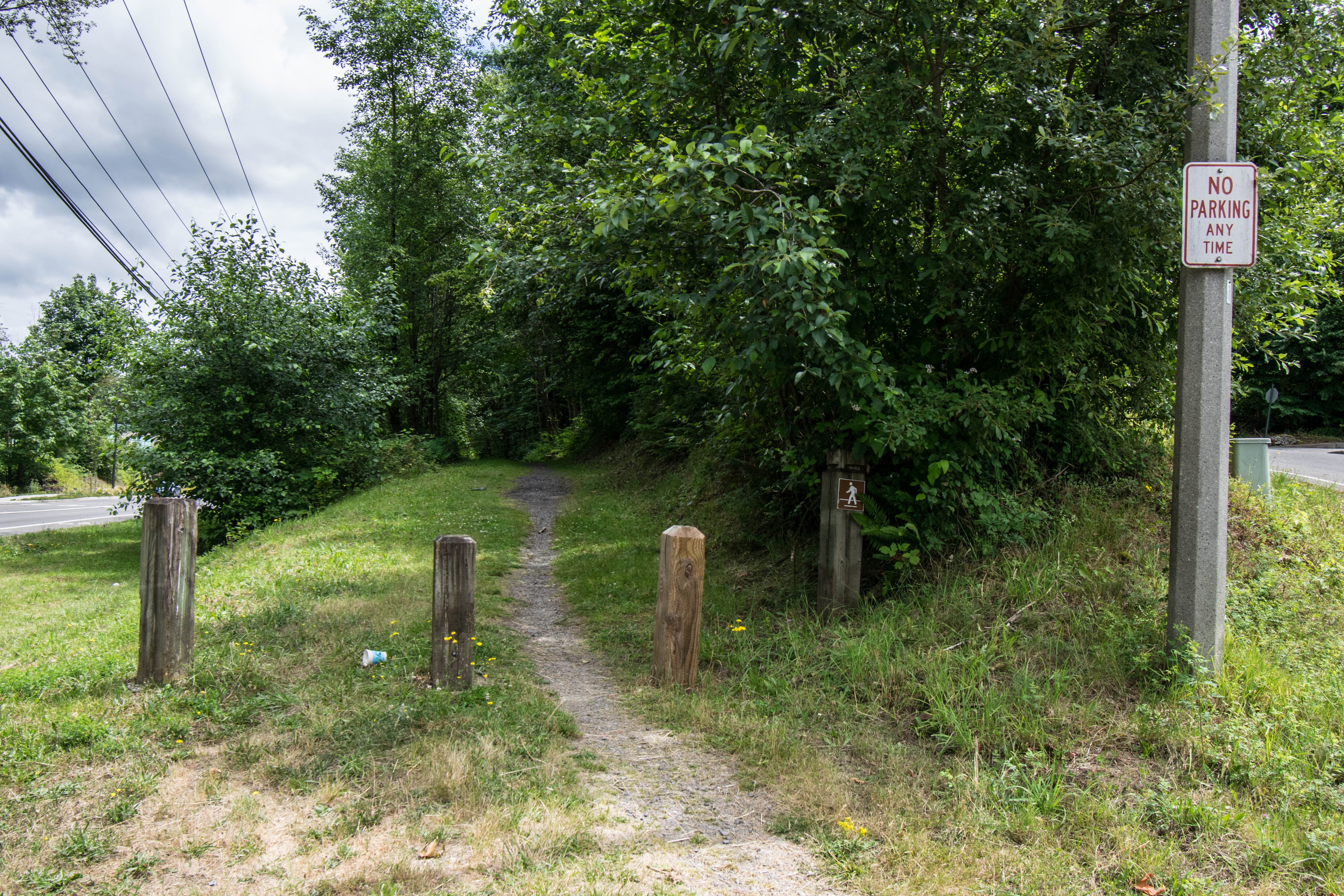
01 Trailhead on Newcastle Golf Club Road
02 End of Trail at 155th Ave SE
Overview
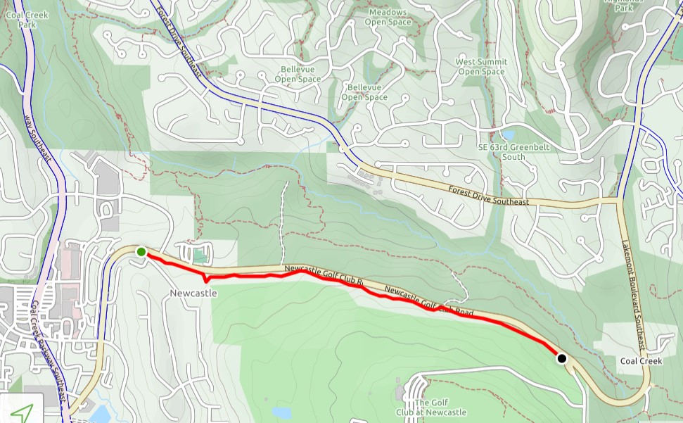
1.3 miles
0 Roads,
0 Driveways
![]()
![]()
From 136th Ave SE along Newcastle Golf Club Road to 155th Ave SE
Description
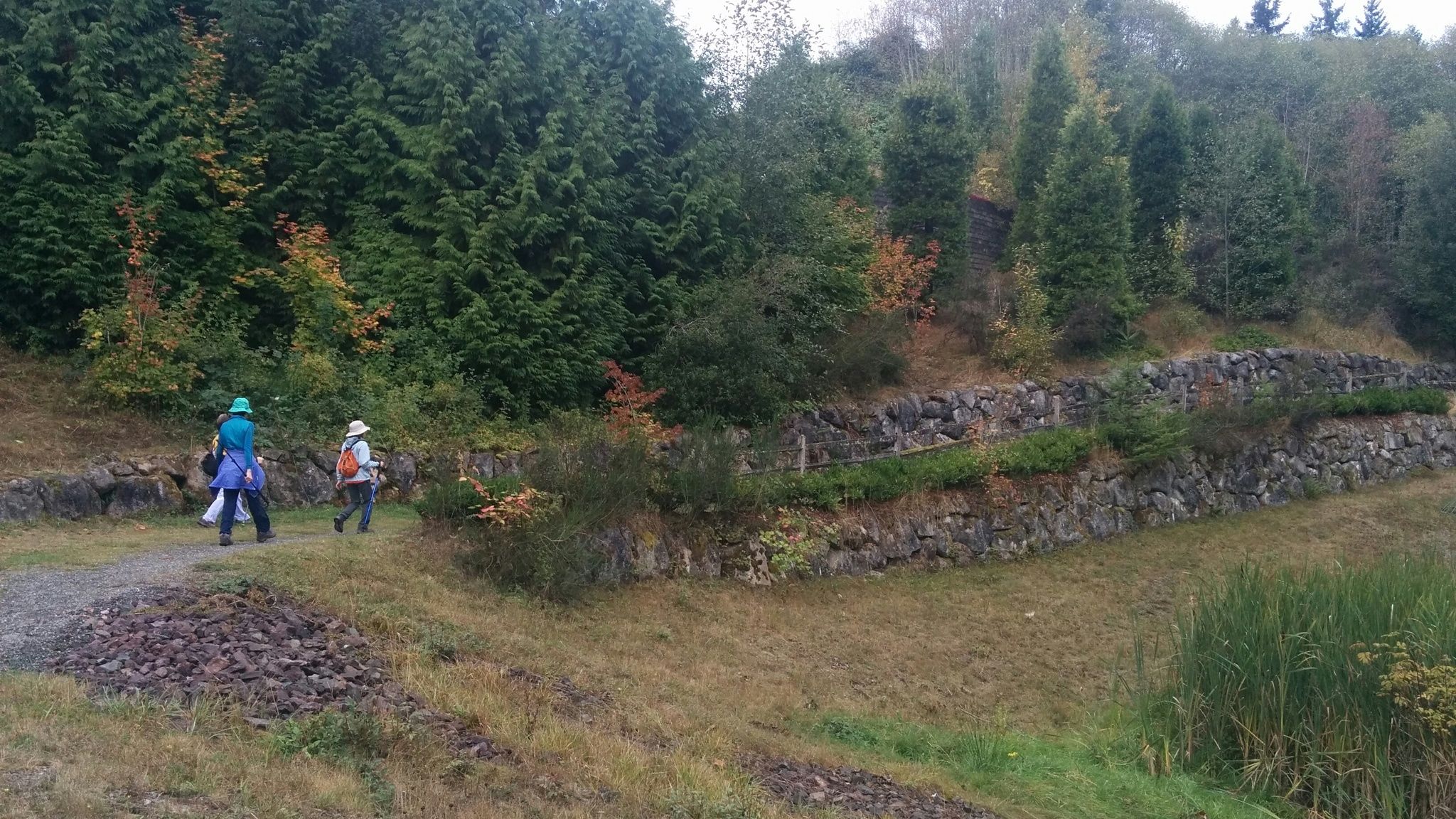
The Golf Course Trail follows Newcastle Golf Club Road (south side) 1.3 miles east from 136th Ave SE (near the YMCA) to 155th Ave SE. From here, a sidewalk and unmarked trail take you .4 miles to the Red Town Trailhead in Cougar Mountain Park. This is a wide, easy trail flanked by trees and dense undergrowth, suitable for horses and walkers of all ages. See Extended Description and Future Plans below.
See Extended Description and Future Plans below.
| Hide Trail Map | ||
|
||
1. The Golf Course Trail starts on the south side of Newcastle Golf Club Road at 136th Ave SE, a short distance from downtown Newcastle. From downtown, take the sidewalk on the west side of NGC Road, walking north and then east to Newcastle Commons Drive (south entrance of Commons). The Coal Creek YMCA is a short distance further east. Take the crosswalk south across NGC Road to the Golf Course Trail.
2. About 180' east from the trailhead (at the crosswalk), trail sign 197 marks the junction with the Thomas Rouse Trail, the first leg of a scenic loop walk: take the crosswalk, follow Newcastle Commons Drive to the Coal Creek Trail, follow it east to Red Town, and use the Golf Course Trail for a shorter, easier return. For a shorter loop via Red Town, take the crosswalk, walk east to the Y, and use the YMCA Trail to join the Coal Creek Trail east of the Commons. 3. The Golf Course Trail continues 1.3 miles east to 155th Ave SE, where the trail ends and Cougar Mountain Park begins. The Red Town Trailhead is .4 miles further on. To reach it, take the crosswalk to the sidewalk and follow it 500 feet uphill, where 155th starts curving to the right. From the small clearing on your left (near a light post), follow a narrow footpath downhill as it widens into one track of a utility road. Turn left on a bigger utility road (trail W5), and continue to the Red Town parking lot. Now you can loop back on the Coal Creek Trail, or make an even bigger loop using the trails in Cougar Mountain Park and the East CrossTown Trail.Future Plans
There's a good case for extending Newcastle's Golf Course Trail to join the Coal Creek Trail at the Red Town Trailhead, just as Newcastle's CrossTown Trail connects to the DeLeo Wall Trail (W9) elsewhere in Cougar Mountain Park. And there's a good case for renaming the China Creek Trail (W5) in Red Town to avoid confusion with Newcastle's China Creek Trail.
1. The Golf Course Trail should be extended (by agreement with King County) to the Red Town Trailhead on the route described in (3) above. And, whether or not the trail is extended, the route should be marked with trail signs. This would complete an important connection to the Coal Creek Trail and the Cougar Mountain trail system. 2. King County's China Creek Trail (W5) starts at Red Town and passes through Newcastle before joining the Wildside Trail (W1) just north of the Steam Hoist Trail (W4). This shared trail (W5) near Red Town should be renamed to avoid confusion with Newcastle's existing China Creek Trail, which passes around the north side of Lake Boren on boardwalks. If completed as proposed, it will follow China Creek to the Marshall's Hill Trail (W6), far distant from the trail (W5) in Red Town.